Show Everyone What’s Going on Without Being There Videos, 3D models, and orthomosaic maps created with drone data can be used to provide clients with detailed, real-time reports on how things are progressing on-site. On larger construction projects, there are often...
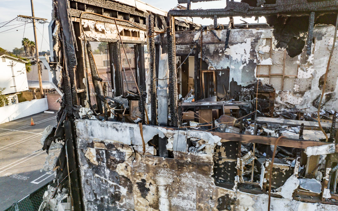
One Picture Can Tell a Thousand Words With so much riding on collecting precise data, choosing the best tools for your case is essential. Drones are another tool that enables attorneys to become better visual storytellers in the courtroom. And often, when tools are...
Stand Out in a Tight Market with Listing Photos that Show More Detail to Buyers With 96% of homebuyers making their purchasing decisions online, your listing needs to ramp up and grab their attention right away. Generate more clicks that turn into showings and solid...
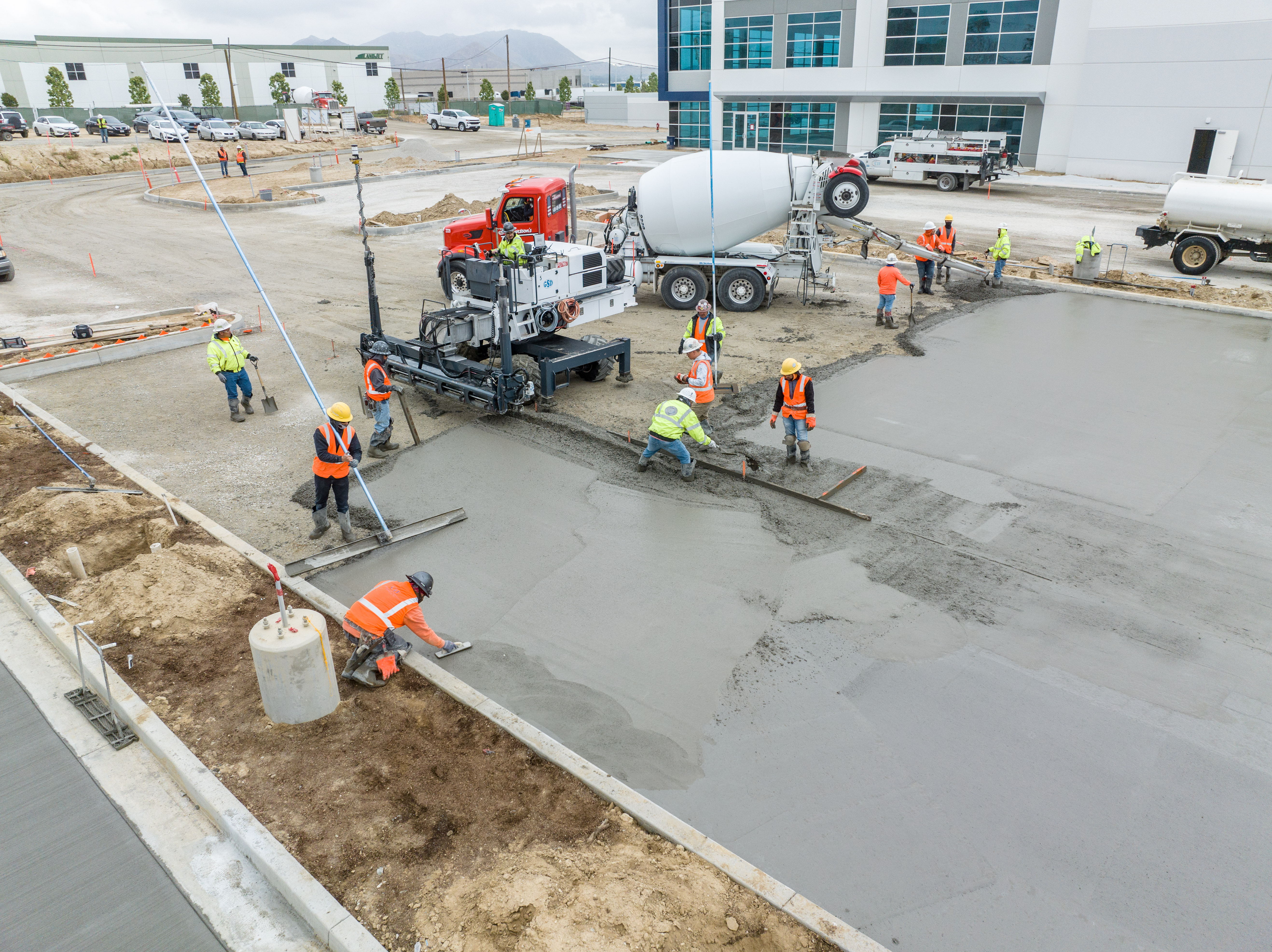
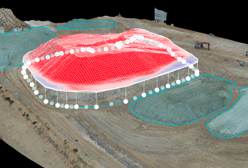
From Mapping to Stockpile Analysis, Drones Give You the Data You Need to Keep Stakeholders up to Date Construction site drone photography reduces risk factors, increases profitability, saves time, and collects a large amount of data that traditionally is...
With a drone, you can put the camera anywhere Need that perfect shot? Drones can offer multiple vantage points that just can’t be gotten without renting a helicopter. And who can afford that? We provide smooth coverage in 4k video that will meld perfectly with the...
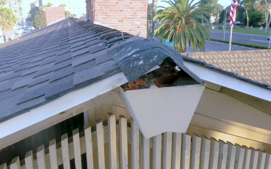
Why Drones Are Better for Rooftop Inspections From residential rooftops to utility-scale power plants, a drone can do an inspection in less time, with more data, and in a much safer way. That’s true whether on a rooftop or on the ground.